Residential Photography
Commercial Property Media
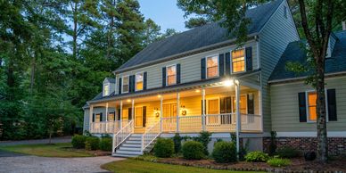
Professional listing photography for real estate agents, homeowners, builders, and property managers.
Residential real estate media can include:
Interior photos
Exterior photos
Drone photos
Walkthrough video
Vertical social media clips
3D virtual tour options
MLS-ready image delivery
Branded and unbranded options
This service is ideal for homes, condos, apartments, rentals, new construction, short-term rentals, and for-sale-by-owner listings.
Commercial Property Media
Commercial Property Media
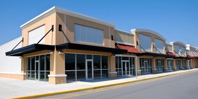
Commercial property media for brokers, business owners, investors, developers, and property owners.
Commercial real estate media can include:
Aerial property photos
Ground-level photos
Tenant frontage photos
Parking and access photos
Road frontage photos
Signage photos
Surrounding area context
Commercial property video
Virtual walkthrough options
This service is ideal for retail buildings, office spaces, warehouses, restaurants, churches, event venues, multi-tenant properties, investment properties, and development sites.
Aerial Drone Photography
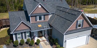
Aerial media gives buyers and decision-makers a better understanding of the property, layout, location, and surroundings.
Drone real estate photography is ideal for showing:
Property layout
Large lots
Road access
Nearby roads
Surrounding businesses
Parking areas
Land features
Rooflines
Acreage
Development potential
All aerial work is completed by an FAA Part 107 certified drone pilot.
Land & Acreage Shots
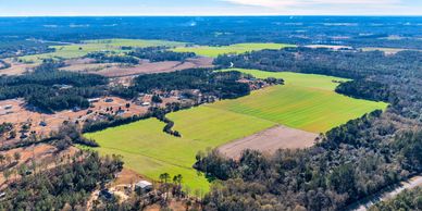
Vacant land, acreage, and rural property need strong visuals to help buyers understand the opportunity.
Land and acreage media can include:
Aerial photos
Ground access photos
Road frontage photos
Property feature photos
Boundary-style visuals
Surrounding area context
Nearby road and location views
Short land marketing video
This service is ideal for vacant lots, farms, rural property, recreational land, timber property, commercial land, and development sites.
Immersive Virtual Tours

Virtual tours help buyers, tenants, and decision-makers view a property remotely and better understand the layout and flow of the space.
3D virtual tours are ideal for:
Residential listings
Commercial spaces
Apartments
Rental properties
Offices
Retail spaces
Churches
Event venues
New construction
Businesses
Virtual tours are a strong add-on for properties where layout, space, and remote viewing are important.
Construction Visuals
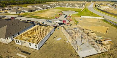
Bates Real Estate Photography & Drone Media also provides media for builders, developers, and property owners who need updated visuals for new construction or development projects.
Services can include:
Progress photos
Aerial updates
Ground-level property photos
Marketing photos
Video updates
Virtual tour options
Development site media
This service is ideal for builders, developers, investors, and owners who want clean visual updates throughout a project.
Property Condition Pics
Property Condition Pics
Property Condition Pics
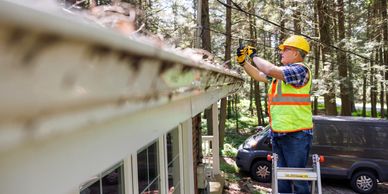
Photos and videos to document visible property conditions.
Aerial documentation can be useful for property owners, contractors, landlords, developers, real estate professionals, and businesses who need clear visual records of a property or project.
Please note: This service provides visual documentation only and does not replace a licensed inspection, insurance adjustment, or engineering report.